


MAROA 1 Voting District, Macon County, Illinois
About
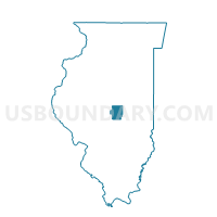
Outline

Summary
| Unique Area Identifier | 573100 |
| Name | MAROA 1 Voting District |
| County | Macon County |
| State | Illinois |
| Area (square miles) | 16.96 |
| Land Area (square miles) | 16.96 |
| Water Area (square miles) | 0.00 |
| % of Land Area | 100.00 |
| % of Water Area | 0.00 |
| Latitude of the Internal Point | 40.01765690 |
| Longtitude of the Internal Point | -88.92166880 |
Maps


Graphs
Select a template below for downloading or customizing gragh for MAROA 1 Voting District, Macon County, Illinois


Neighbors
Neighoring Voting District (by Name) Neighboring Voting District on the Map
- CREEK Voting District, De Witt County, IL
- FRIENDS CREEK 1 Voting District, Macon County, IL
- HICKORY PT 1 Voting District, Macon County, IL
- HICKORY PT 14 Voting District, Macon County, IL
- MAROA 2 Voting District, Macon County, IL
- TEXAS Voting District, De Witt County, IL
- WHITMORE 4 Voting District, Macon County, IL
Top 10 Neighboring County Subdivision (by Population) Neighboring County Subdivision on the Map
- Hickory Point township, Macon County, IL (18,523)
- Whitmore township, Macon County, IL (4,471)
- Maroa township, Macon County, IL (2,100)
- Friends Creek township, Macon County, IL (1,450)
- Texas township, De Witt County, IL (1,246)
- Creek township, De Witt County, IL (471)
Top 10 Neighboring Place (by Population) Neighboring Place on the Map
Top 10 Neighboring Unified School District (by Population) Neighboring Unified School District on the Map
- Maroa-Forsyth Community Unit School District 2, IL (6,359)
- Argenta-Oreana Community Unit School District 1, IL (4,127)
Top 10 Neighboring State Legislative District Lower Chamber (by Population) Neighboring State Legislative District Lower Chamber on the Map
Top 10 Neighboring State Legislative District Upper Chamber (by Population) Neighboring State Legislative District Upper Chamber on the Map
Top 10 Neighboring 111th Congressional District (by Population) Neighboring 111th Congressional District on the Map
Top 10 Neighboring Census Tract (by Population) Neighboring Census Tract on the Map
- Census Tract 22, Macon County, IL (5,553)
- Census Tract 29.01, Macon County, IL (3,982)
- Census Tract 30, Macon County, IL (3,550)
- Census Tract 9715, De Witt County, IL (2,853)